Welcome, Commercial Drone Pilots!
Join our growing community today!
Sign up

Has anyone used MAPWARE

Salty Sam

Member
Joined
Sep 1, 2020
Messages
11
Reaction score
7
Age
74
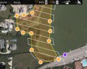
I have downloaded the free trial version of MAPWARE and processed a project to map 25 acres @ 200' 287 images. The results seemed okay to do progress tracking.

Does anyone have any experience with this software. Is there a better software package (cheaper) that lets you pay on a per project basis?
 
I use the free Map Pilot Pro app by Maps Made Easy. You can either purchase a subscription or pay as you go which is what I do. You pay for the processing of images using "points", which you purchase based on the number of photos and type of processing one needs. I find it to be relatively inexpensive, especially for the number of images you've mentioned.
 
I have a question regarding Map Pilot Pro boundaries. I have used DroneDeploy extensively, but after its recent updates to become a secondary enforcer of DJI’s airspace overreach, I am about to try MPP.
Question is: When scribing a map in my iPad, it shows the flight path extends further than the map coordinates. Since I often fly next to tall buildings or next to roads with traffic that I do not wish to fly over, does the drone fly past the boundaries of the area you wish to map?
Yes. The Map Pilot Pro flight pattern will extend slightly beyond the boundary that you draw to ensure that angular coverage is complete for correct processing of the images. This is especially needed for 3D rendering. The white flight pattern represents the exact path the drone will fly, so you could always adjust/drag the yellow dots of the boundary vertices back a little so you avoid flying over a bordering roadway. The white flight lines will automatically adjust.
 

Attachments

  • example.jpg
    example.jpg
    134.8 KB · Views: 2
Last edited:
  • Like
Reactions: BigAl07

Members online

No members online now.

Forum statistics

Threads
4,277
Messages
37,605
Members
5,969
Latest member
KC5JIM