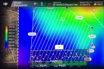
I've done a lot of successful 2D and 3D mapping with my P4 RTK and recently attempted to do a flight with the Terrain Awareness mode. As best as I can determine, everything was planned correctly and the DSM loaded correctly but, when attempting to invoke the launch, I would get a message "Low GNSS accuracy. Enable RTK services for increased flight safety." Wide open area, good view of the sky, lots of satellites, good communications between the drone, controller and RTK base station. Everything appeared to be good so continued on with the Invoke but nothing would start in the "Self-check Before Executing Task" screen when sliding the "Slide to Execute" slider on the yellow bar. In that same screen, the "aircraft GNSS signal" displayed "Good (14)". So, shut everything down and restarted the whole process. Did that three times with same results. As a last ditch effort and running out of time, I quickly created a 2D flight plan for the site and successfully launched and flew without any issues. Any insights as to why the system would give me that message while trying to do a Terrain Awareness mode flight when there seemed to be excellent satellite reception, and then work just fine in a regular 2D mode? What am I missing? Thanks.


Terrain Awareness Mode _ gnss accuracy message when attempting to invoke the flight
- Thread starter SteveBCH
- Start date


New Posts
-
 Sharing My Music and Sound Effects - Over 2000 Tracks
- Latest: Eric Matyas
-
-

-

Members online
No members online now.