Welcome, Commercial Drone Pilots!
Join our growing community today!
Sign up

Pricing Construction Projects

Fly Addie Fly

Active Member
Joined
Feb 16, 2022
Messages
37
Reaction score
29
Age
60
I was contacted by a client that is building a new home. She is requesting pricing from me. I looked around the internet to investigate prices. I found that packages range from one monthly visit to the site/6 unedited aerial pics and one unedited video clip for $125, Bi-Weekly $175 , weekly visits to the site $275. Are these prices in line with a typical job? Any suggestions on how to better price a construction site and info on what to include in the package welcomed. Thank you
 
  • Like
Reactions: BigAl07
Pricing is a TOUGH one. Only you know what it costs to run your business.

I do a LOT of Construction Progress Documenting (I'm in the construction business already). My area supports a higher price than some for this type of service but (this is going to come off bad) I bring a lot of experience and knowledge to the table. I visit construction sites often, know construction inside and out, and I have both Commercial and Residential Construction knowledge to be able to add value for my clients. I can notate details, document assemblies, and in one case even noted a drainage issue that was not noted except from me.

We charge $250/trip unless they book in BULK and that price goes down "some" depending on how many site visits they want shot.

You need to figure out how much preplanning is needed (some site visits may be needed prior to flying), how long you'll spend traveling to the site, how long ON site, how long in Post Processing, how much you'll have invested TOTAL per shoot, and then how much you NEED to make per hour.

You really need to take the time to get a solid and comprehensive Business Plan put together. This will not only help you establish your price structure, it COULD save you some $$. I teach my students to always START with the BP before they spend a single penny on equipment etc. You need to know where you ARE before you start down the road of running a small business.

Also the Business Plan will, through the building of it, teach you what your competition is charging and maybe help you know better what your local economy will support. If you come out charging too MUCH or too LITTLE you may be setting up for failure.
 
Here's a long post I made last year that might help shed some light:

 
  • Like
Reactions: LeadSledGirl-CDP
By doing a business plan you will also be able to determine what the market will bare in your area. I think BigA is right on. As for the prices you quoted, I think they are a bit low.
 
  • Like
Reactions: RGB and BigAl07
Pricing is a TOUGH one. Only you know what it costs to run your business.

I do a LOT of Construction Progress Documenting (I'm in the construction business already). My area supports a higher price than some for this type of service but (this is going to come off bad) I bring a lot of experience and knowledge to the table. I visit construction sites often, know construction inside and out, and I have both Commercial and Residential Construction knowledge to be able to add value for my clients. I can notate details, document assemblies, and in one case even noted a drainage issue that was not noted except from me.

We charge $250/trip unless they book in BULK and that price goes down "some" depending on how many site visits they want shot.

You need to figure out how much preplanning is needed (some site visits may be needed prior to flying), how long you'll spend traveling to the site, how long ON site, how long in Post Processing, how much you'll have invested TOTAL per shoot, and then how much you NEED to make per hour.

You really need to take the time to get a solid and comprehensive Business Plan put together. This will not only help you establish your price structure, it COULD save you some $$. I teach my students to always START with the BP before they spend a single penny on equipment etc. You need to know where you ARE before you start down the road of running a small business.

Also the Business Plan will, through the building of it, teach you what your competition is charging and maybe help you know better what your local economy will support. If you come out charging too MUCH or too LITTLE you may be setting up for failure.
Sound advise, I have been learning so much. I just started shooting real estate sites at no charge to build a client base. Also, just applied for my first waiver with DroneZone. I was under the impression that in a class C airspace you can fly without a waiver under 4oo' but I was wrong. Whitting Air Field is a Naval Base that requires authorization.
Do you have a business plan template our outline you can share with me? I am currently working on setting pricing.
 
  • Like
Reactions: BigAl07
Sound advise, I have been learning so much. I just started shooting real estate sites at no charge to build a client base. Also, just applied for my first waiver with DroneZone. I was under the impression that in a class C airspace you can fly without a waiver under 4oo' but I was wrong. Whitting Air Field is a Naval Base that requires authorization.
Do you have a business plan template our outline you can share with me? I am currently working on setting pricing.

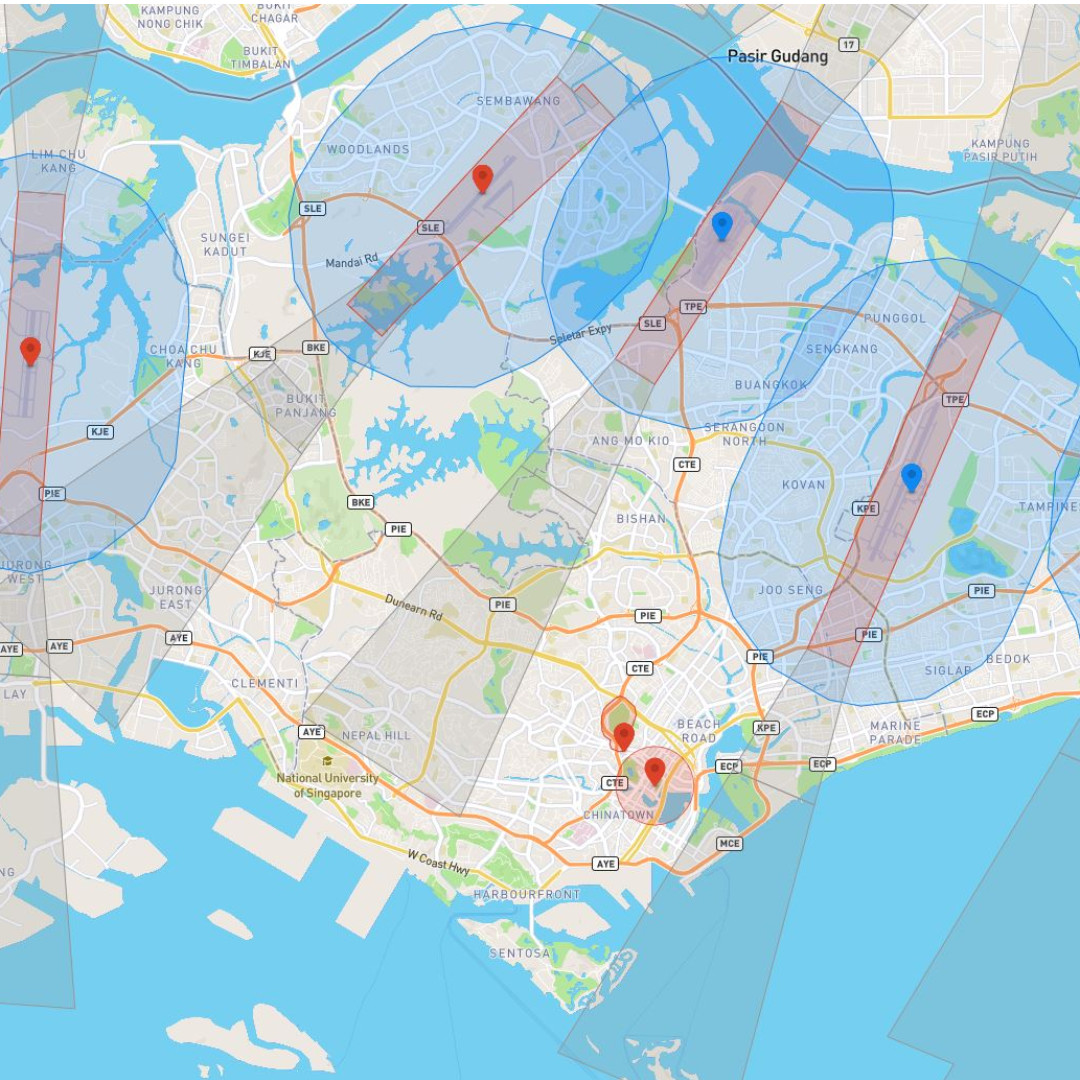
For any LAANC airspace you can check this map

This little boxes are the MAX altitude you'll "likely" get approved for but that is not an approval. It the aircraft goes into any portion of the box you MUST get approval to fly in that area period. Hope that makes sense.

re: BP Template- No that'll be best via google. Keep in mind I'm not talking about that 1-4 page plan you'll see many people toting. Our BP was probably 60ish pages long and we spent nearly 6 months compiling it with the help of some local college students. If you want some more incite there drop me a PM and I'll provide more details and suggestions.
Thanks...will do!
 
Thanks...will do!
For any LAANC airspace you can check this map

This little boxes are the MAX altitude you'll "likely" get approved for but that is not an approval. It the aircraft goes into any portion of the box you MUST get approval to fly in that area period. Hope that makes sense.

re: BP Template- No that'll be best via google. Keep in mind I'm not talking about that 1-4 page plan you'll see many people toting. Our BP was probably 60ish pages long and we spent nearly 6 months compiling it with the help of some local college students. If you want some more incite there drop me a PM and I'll provide more details and suggestions.
By the way...great map...Here is the data on the airport C class that is infringing on the location I wish to film..
FAA UAS Facility Map Data V5: Whiting Fld NAS South

Ceiling400
Ceiling Unit of Measure in FeetFeet
Effective Date of the UAS Facility Base Map2/24/2022
Date of Last Data Change9/12/2019
Latitude30.6292
Longitude-87.0375
Global Unique Identifier6655a587-6cf0-4b76-bec8-f102326c2137
Airport Count1
 
When flying in any Surface Controlled Airspace, you must have permission from the FAA for the flight. You can gain this in many locations via the LAANC system. Other locations, not LAANC enabled, you go through DroneZone and it can take time for approval. Best to get a Wide Area Certificate of Authorization (CoA) for that airspace. They're good for 2 years in most cases.

If you use DJI aircraft, please note that their FlySafe Geofencing software is not connected to the FAA, and just because you have authorization from the FAA (via LAANC or a CoA) does not automagically unlock the DJI FlySafe Zone. You have to go through DJI and gain an Unlock Code, download it to your controller and aircraft. It's always a good idea, when flying in Surface Controlled Airspace, to also check the DJI FlySafe Map and get a code if you need it. Overlook this step and you may find yourself unable to fly, even with FAA authorization, because the DJI FlySafe Geofencing denies you.
I just applied on DroneZone for permission. Once I receive their permission, I will have to figure out how to load the permission to my DJI. Thank again!
 
Once you have the FAA Authorization, you can refer to it when requesting DJI FlySafe to grant the Unlock Code.

When I setup my account on the DJI FlySafe website, I did it as a Commercial Account. Used company letterhead for the requested info and referenced all of my CoA's. Whenever I need an Unlock Code, it takes just minutes to get the approval.
 
  • Like
Reactions: MikeA
I just applied on DroneZone for permission. Once I receive their permission, I will have to figure out how to load the permission to my DJI. Thank again!
I'll probably get in trouble for saying this, but DJI geo fence can break, and I think it is a good idea to break it. It saves so much time and frustration not needing to deal with geo fence. There is no legal requirement to use it here in the US.
 
  • Like
Reactions: BigL and BigAl07
I'll probably get in trouble for saying this, but DJI geo fence can break, and I think it is a good idea to break it. It saves so much time and frustration not needing to deal with geo fence. There is no legal requirement to use it here in the US.


Agreed :)
 
Try this
 
That's why I specified the Mavic2 Pro......I'm not aware of any solutions for it.

What will I do with it? Simply eliminate another step in flight planning. Not having that nagging thought in the back of my mind: "I sure hope the Unlock Code works"....although it always has worked.

I deal with the DJI FlySafe because it's a necessary evil, as I love my M2P and use it for probably 80% of missions. It's such a reliable, solid flyer and the camera is fantastic. Occusync is really solid, even in heavily congested wi-fi areas. It would be nice to not have the Geofencing. I'm an FAA Certificated pilot and know where I can and cannot fly and what my limits are. It's like having a car you can't drive in certain areas unless I get an Unlock Code from GM.
 
  • Like
Reactions: JimD and BigAl07
That's why I specified the Mavic2 Pro......I'm not aware of any solutions for it.

What will I do with it? Simply eliminate another step in flight planning. Not having that nagging thought in the back of my mind: "I sure hope the Unlock Code works"....although it always has worked.

I deal with the DJI FlySafe because it's a necessary evil, as I love my M2P and use it for probably 80% of missions. It's such a reliable, solid flyer and the camera is fantastic. Occusync is really solid, even in heavily congested wi-fi areas. It would be nice to not have the Geofencing. I'm an FAA Certificated pilot and know where I can and cannot fly and what my limits are. It's like having a car you can't drive in certain areas unless I get an Unlock Code from GM.


Have you looked into nolimitdronez.com

I'm about to use that on my M2P and my M2Z.

Here's a good thread about it over on MP you should check out:
 
I have not in a while as they hadn't cracked the M2's yet. If they have and you're successful, let me know.

EDIT: I should clarify that my M2P was manufactured after a certain firmware level that can no longer be downgraded, and it is running the most current version. The only solution NLD had for me was a board swap.
 
  • Like
Reactions: BigAl07
I was contacted by a client that is building a new home. She is requesting pricing from me. I looked around the internet to investigate prices. I found that packages range from one monthly visit to the site/6 unedited aerial pics and one unedited video clip for $125, Bi-Weekly $175 , weekly visits to the site $275. Are these prices in line with a typical job? Any suggestions on how to better price a construction site and info on what to include in the package welcomed. Thank you
I concur with BigA107's pricing advice. Most importantly, don't undervalue your talent and time. I'm in NE Florida and my minimum callout fee is $250 for even the most basic of missions. Anything less and my time would be better spent on marketing. My background in commercial aviation taught me the key to profitability is long term contracts. One-off's can serve as nice little fillers, but you can't sustain a career with piece work where the barrier to entry is so low. And please don't get me started on how drone networks have commoditized pilots and driven down compensation. Find your niche, excel at it, and charge appropriately for it.
 

Members online

Forum statistics

Threads
4,277
Messages
37,605
Members
5,969
Latest member
KC5JIM