

LUIS MARTINEZ
Well-Known Member
- Joined
- Dec 24, 2017
- Messages
- 1,218
- Reaction score
- 1,048
- Age
- 73
- Location
- CASA GRANDE, AZ
- Website
- www.martinezaerial.com
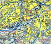
images? lat/lon?Ok now I’m confused. I’m looking to do a commercial flight at this particular address and on the official UAS facility maps it’s in a 200 ft grid. However if I go to AirMap, Skyward, or Kittyhawk to get a LAANC authorization, that same exact location is shown outside of controlled airspace and it won’t allow me to get authorization. If I try to submit to LAANC It just says “The planned operation falls outside of controlled airspace”. Any ideas?


")


