- Joined
- Jan 11, 2018
- Messages
- 15
- Reaction score
- 4
- Age
- 54
- Location
- Bishop, CA
- Website
- www.esaerialmapping.com
I had a couple of questions about SAR that I've been going over. I joined our local SAR group almost a year ago hoping to be able to use my UAV and skills to assist someone in need. We have not had the need since I joined, but I see possible issues. The area we cover is large (Mt Whitney to Death Valley) and most rescues are technical in nature and do not need searching capabilities of a UAV. The first question I have is regarding flying in wilderness or National Park areas. I know both are not allowed, but has anyone looked into getting or received some kind of "blanket" permission for SAR missions? If so what process was followed? Or even if you've gotten case by case permission, I would be curious to know. I am worried that I will not be able to get permission in time to be useful in a search situation.
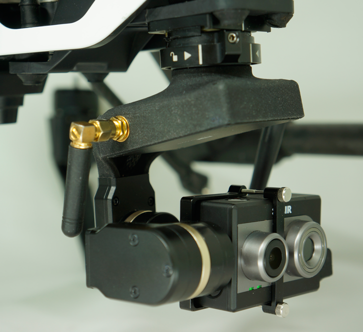
Second I am looking for anyone with experience using FLIR in SAR missions. I am looking into dronexpert.nl's solutions, and they look pretty good. If anyone has some FLIR experience, I'd love to hear it.
Thanks,
Nik
Second I am looking for anyone with experience using FLIR in SAR missions. I am looking into dronexpert.nl's solutions, and they look pretty good. If anyone has some FLIR experience, I'd love to hear it.
Thanks,
Nik


")